david ouyang moench
Project - Forest Landcover Estimation using Image Segmentation
I’ve explored the problem of semantic segmentation of satellite images of the Chesapeake Bay watershed in two ways:
- Using a convolutional neural network. i.e. A deep learning approach.
- Using SVMs. i.e. A traditional machine learning approach.
CNN Approach (W.I.P.)
Detailed in this Kaggle notebook.

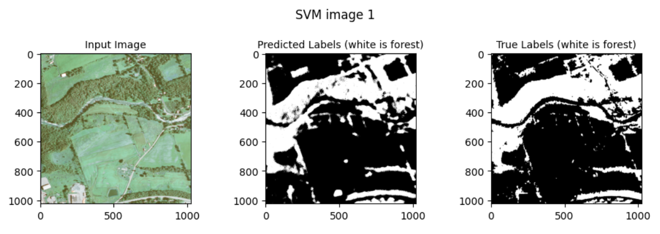
SVM Approach
I took a class on Data Mining in Fall ‘22 as part of my Master’s at Hopkins, and used the final project as a chance to apply machine learning to a climate-change-related problem: Using ‘traditional’ machine learning to estimate the amount of forest coverage shown in a satellite image of a geographic area.
I developed a binary classifier to perform image segmentation of satellite images of the Chesapeake Bay watershed, labeling each pixel as either forest or non-forest landcover, as an application of the support vector machine (SVM) model approach to linear classification.
Here’s a video presentation of the project:
The full write-up and Jupyter Lab code can be found HERE